The global expansion of offshore wind energy is opening new horizons while posing significant challenges for modern marine geophysics. By the end of 2023, the cumulative installed capacity of offshore wind farms exceeded 60 GW, and is projected to reach 150 GW by 2030. This rapid growth is driven by three key factors: a sharp reduction in the levelized cost of energy (LCOE) due to project scaling and technological advances; global decarbonization policies stimulating investment; and the emergence of new solutions such as floating platforms and turbines with capacities exceeding 20 MW.
New conditions – new requirements for geophysics
At the same time, the industry is moving into more complex marine environments, where average turbine installation depths reach 50-60 meters and, in prospective projects, exceed 100 meters. This transition fundamentally changes the requirements for engineering surveys and presents geophysics with a new set of complex challenges. Foremost among these are risks associated with complex shelf geology: the presence of weak silty and clayey soils, gas-charged zones, and lenses of hard rock, which can lead to uneven foundation settlement or create artifacts in seismic sections.
Operations at greater depths further exacerbate these issues. Traditional signal sources lose effectiveness, and the signal-to-noise ratio deteriorates, necessitating the use of more powerful and sophisticated geophysical systems. In addition, project scaling entails the development of extensive subsea cable networks, where any routing error can result in multimillion-dollar losses.
Under these conditions, the key task for geophysicists is no longer merely data acquisition, but the creation of a highly accurate and integrated geological model. This includes detailed bathymetric surveys with resolutions down to 10 cm, early identification of geological hazards such as landslides and gas pockets, and - most importantly - 3D data interpretation for precise calculation of foundation loads and optimal cable route planning.
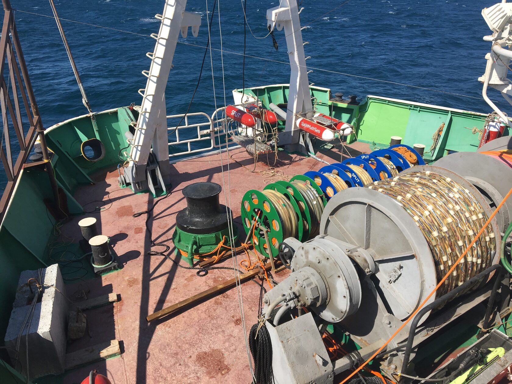
Split technological solutions for offshore wind energy
Addressing these challenges requires specialized technological solutions, such as those developed by Split, which have already been applied in projects in the Kara Sea and the Baltic Sea:
In this way, modern technological solutions are no longer merely tools, but a prerequisite for ensuring safety, reducing risks, and meeting budgetary and scheduling constraints in next-generation offshore wind projects.
New conditions – new requirements for geophysics
At the same time, the industry is moving into more complex marine environments, where average turbine installation depths reach 50-60 meters and, in prospective projects, exceed 100 meters. This transition fundamentally changes the requirements for engineering surveys and presents geophysics with a new set of complex challenges. Foremost among these are risks associated with complex shelf geology: the presence of weak silty and clayey soils, gas-charged zones, and lenses of hard rock, which can lead to uneven foundation settlement or create artifacts in seismic sections.
Operations at greater depths further exacerbate these issues. Traditional signal sources lose effectiveness, and the signal-to-noise ratio deteriorates, necessitating the use of more powerful and sophisticated geophysical systems. In addition, project scaling entails the development of extensive subsea cable networks, where any routing error can result in multimillion-dollar losses.
Under these conditions, the key task for geophysicists is no longer merely data acquisition, but the creation of a highly accurate and integrated geological model. This includes detailed bathymetric surveys with resolutions down to 10 cm, early identification of geological hazards such as landslides and gas pockets, and - most importantly - 3D data interpretation for precise calculation of foundation loads and optimal cable route planning.
Split technological solutions for offshore wind energy
Addressing these challenges requires specialized technological solutions, such as those developed by Split, which have already been applied in projects in the Kara Sea and the Baltic Sea:
- SplitMultiSeis3D is a high-resolution, three-frequency seismic system that enables the construction of detailed 3D maps of sedimentary sequences. It allows confident identification of gas lenses and carbonate inclusions, which is critical for risk assessment during foundation design.
- SplitGunDeepMaster is a combined signal source system that integrates shallow-water and deep-water air guns. Its key advantage is the preservation of pulse power and clarity at depths of up to 100 meters, minimizing noise and ensuring high data quality in deep-water conditions.
- SborEx AI & QC is an artificial intelligence–based module for real-time analysis of incoming geophysical profiles. The system continuously monitors signal-to-noise ratios and other quality parameters, enabling on-the-fly adjustment of survey settings during operations.
- SborExNav & SMS Geometry Input is a precision positioning system for towed streamers and survey line geometry calculation. It eliminates drift and ensures millimeter-level positional accuracy, which is a mandatory requirement for the design of dense cable and foundation networks.
In this way, modern technological solutions are no longer merely tools, but a prerequisite for ensuring safety, reducing risks, and meeting budgetary and scheduling constraints in next-generation offshore wind projects.